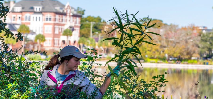
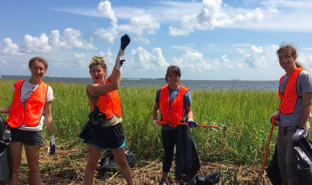
Charleston Daily is a concept in community. Its mission is to promote, assist, and celebrate in everything Charleston, South Carolina. By partnering with businesses, community leaders, volunteers and events, we are spreading the love that is Charleston.
As this city continues to grow and prosper, we want to help spread the message to all about how wonderful this community is.
Charleston is about the people, community, water, land, history, heritage and the true southern warmth it brings with each and every day.
New stores will be located in Florida, Indiana, South Carolina and Tennessee
Each of the five planned locations will help generate 150 new jobs for people in the areas where they open, the Massachusetts-based company said. BJ’s, with a smaller warehouse footprint, competes with Sam’s Club and Costco Wholesale.
Two of the new locations will be in Florida, operating in Palm Coast and West Palm Beach. The others will be located in Carmel, Indiana; Myrtle Beach, South Carolina; and Maryville, Tennessee.
“Our real estate pipeline is the strongest it’s been in 20 years, and we look forward to helping even more families save up to 25% off grocery store prices as we add clubs to both new and existing markets,” Bill Werner, BJ’s executive vice president of strategy and development, said in a statement.
BJ’s expansion plan for fiscal 2024 includes establishing 12 new clubs. It has also indicated it would open 15 gas stations.
During the company’s quarterly earnings call earlier in March, Werner said BJ’s locations “are outperforming on the sell side, and we see really great member acquisition, member engagement” over the last couple of years.
The company’s real estate footprint spans 20 states with 244 clubs and 175 gas locations.
[CHARLESTON COUNTY] – The Charleston County Park and Recreation Commission (CCPRC) is proud to announce that it has been awarded $24,590 as part of the Christopher & Dana Reeve Foundation National Paralysis Resource Center (NPRC) 2023 Direct Effect 2nd Cycle Quality of Life grants. Through this grant, Charleston County Parks was able to purchase 10 TerraWheels Beach Wheelchairs for use at Isle of Palms County Park, Folly Beach County Park, Kiawah Beachwalker Park, and the Folly Beach Pier.
Fifty-nine grants totaling $1,271,125 were awarded. The Quality of Life Grants Program supports nonprofit organizations that empower individuals living with paralysis. Since the Quality of Life Grants Program’s inception, more than 3,770 grants totaling $43 million have been awarded. Funding for this program was made possible through a cooperative agreement with the Administration for Community Living (ACL grant #90PRRC0006-03-01). The Reeve Foundation’s National Paralysis Resource Center has several grants under the Quality of Life program awarding grants in different category areas, varying in different amounts. The Direct Effect grants program funds organizations to support a wide range of projects and activities that will impact individuals living with paralysis and their families.
“These awards are about restoring independence to our constituents,” said Dan McNeal, Director of, the Quality of Life Grants Program, Reeve Foundation. “Our work and number one goal are to enhance the quality of life of people living with paralysis. It is our honor to continue to collaborate with so many dedicated organizations, which have selflessly given their time and efforts to ensure that accessibility and inclusivity remain embedded in the fabric of their programs.”
“CCPRC is thrilled to have received a Quality of Life Grant from the Christopher and Dana Reeve Foundation. We look forward to the improved service this grant will enable us to provide via 10 new beach wheelchairs at the four ocean access parks we operate,” said Steve Hutton, CCPRC’s director of recreation and ADA coordinator. “Improving accessibility throughout our system is one of our core values, and the addition of these new beach wheelchairs will greatly help us achieve our goals and better serve our visitors who experience challenges when it comes to accessing beaches and other recreation areas.”
The beach wheelchairs are available for public use on a first-come, first-serve basis at Isle of Palms County Park, Folly Beach County Park, the Folly Beach Pier, and Kiawah Beachwalker Park during regular park hours. Please visit the park office upon arrival to check out a wheelchair. Reservations are not available for the chairs, but you may call the park office in advance to check availability. For more information, visit Charleston County Parks’ accessibility webpage at www.ccprc.com/ADA. For hours and contact information for the parks, please visit CharlestonCountyParks.com.
About the Reeve Foundation:
TheChristopher & Dana Reeve Foundation is dedicated to curing spinal cord injury by funding innovative research and improving the quality of life for individuals and families impacted by paralysis. By uniting the brightest minds in the field, we are working tirelessly to accelerate scientific discoveries across the field of spinal cord research by investing in labs across the globe. Additionally, through a cooperative agreement with the Administration for Community Living, the Reeve Foundation’s NationalParalysis Resource Center (NPRC) promotes the health, well-being, and independence of people living with paralysis, providing comprehensive information, resources, and referral services assisting over 100,000 individuals and families since its launch in 2002. The Reeve Foundation is committed to elevating our community’s voices and needs to achieve greater representation and independence. We meet all 20 of the Better Business Bureau’s standards for charity accountability and hold the BBB’s Charity Seal. For more information, please visit www.ChristopherReeve.org or call 800-225-0292.
About CCPRC:
The mission of CCPRC is to improve the quality of life in Charleston County by offering a diverse system of park facilities, programs and services. The large park system features over 11,000 acres of property and includes six regional parks, three beach parks, four seasonally-lifeguarded beach areas, three dog parks, two landmark fishing piers, three waterparks, 19 boat landings, a skate park, a historic plantation site, a climbing wall, a challenge course, an interpretive center, an equestrian center, cottages, a campground, a marina, as well as wedding, meeting and event facilities. CCPRC also offers a wide variety of recreational services – festivals, camps, classes, programs, and much more. For more information on CCPRC, call 843-795-4386 or visit www.charlestoncountyparks.com.
Frederick Douglass: No Turning Back receives Silver Crown Award at ICVM in Nashville
The award-winning film, Frederick Douglass, No Turning Back, in worldwide distribution through Bridgestone Multimedia Group has won a Silver Crown Award in the 51st Crown Awards competition at the International Christian Media Convention in Nashville.
The film, starring Kyle Taylor, explores the success of Frederick Douglass’ national tour in 1872, as he thrilled and inspired audiences across America sharing his journey from slavery to national leader. He also shares his quest to abolish all types of slavery in the world and promote lasting freedom in America. His wisdom and brilliant wit are very timely for today.
The film was created by adapter, director and producer, Chris Weatherhead, from all three autobiographies of Mr. Douglass, and features nationally known actor, Clarence Felder, as Pastor Brewster, leader of an integrated church who has brought Mr. Douglass to speak. By this time, the nation had completed the civil war, and passage of the 13th, 14th and 15th Amendments of the US Constitution.
Mr. Taylor and Ms. Weatherhead are available for interviews about the journey of this film and its relevance.World distribution of the film is through Bridgestone Multimedia Group/Twin Engines.
The film can be viewed for free on Encourage TV – Click HERE.
Fully Leased NNN Investment Opportunity on one of Charleston most desirable thoroughfares. Current tenants include: Verizon, Domino’s Pizza, Forsberg’s Liquor Store
MOMO Riverfront Park is thrilled to announce the upcoming opening of their second location at Crowfield Golf Club (300 Hamlet Circle, Goose Creek, SC 29445).
Now Goose Creek and all the golf enthusiasts in the area will now experience the luxurious and relaxing experience of Momo right in their backyards.
Follow MOMO Crowfield on INSTAGRAM to stay up to date on the details of the grand opening.
Next time you are in the Park Circle area, make sure you stop in for a great scenic dining experience – MOMO Riverfront Park Menu
Read More
Architectural project construction project concept
As permits and housing starts decline nationwide, South Carolina faces similar challenges in its residential construction sector. Permitting activity in the state has dropped for a second consecutive year, marking a -8% decrease compared to the previous year. This slowdown hints at challenges for housing affordability and availability across the state.
South Carolina issued 45,423 new permits last year, down -8% from the previous year. The drop was particularly sharp for multi-family buildings with 5 or more units (-44%), signaling a tightening market that could limit accessible housing options for residents;
The Charleston metro area witnessed the highest decrease (-7%), with around 8,500 new permits issued last year. Despite the overall decline, there was a notable 89% increase in permits for 2- to 4-unit buildings, suggesting a shift towards smaller multi-unit housing options;
Greenville-Anderson and Columbia, other medium-sized metros, also experienced nearly -6% drops in permitting activity, echoing the statewide pattern of regional housing challenges, affecting construction sectors and potential homebuyers alike;
Myrtle Beach-Conway metro area bucked the statewide trend with a 9% increase in permit issuance. This goes to show that some areas within the state continue to foster opportunities for housing development and improved affordability;
Smaller metros like Sumter and Spartanburg saw nearly -6% decreases in permits for new homes, with Florence close behind at -5%, complicating the quest for affordable housing in these area for potential buyers.
Resource: This extensive resource page features a year-over-year breakdown of residential construction data at the national, state, and metro levels spanning over the last decade.
ADAC UNVEILS Q1 ADDITIONS AND EXPANSIONS, DESIGN CENTER THRIVING AT 90% OCCUPANCY
New Showrooms Include Milieu and French Market Collection
ATLANTA: Continually committed to serving the design industry with fresh offerings, Atlanta Decorative Arts Center (ADAC) is starting the year off strong by bringing on two new showrooms and three current tenant expansions set to open this spring. Milieu and French Market Collection join the roster at the Southeast’s preeminent design destination which is maintaining 90% leased, a high number when considering businesses are still defining retail and office space requirements post-pandemic.
In addition to the two new showrooms, several of ADAC’s existing tenants have recently experienced exponential growth, resulting in the need to expand current space to better accommodate clientele and display an additional range of products and services. Current expansions include C + H Interiors increasing its current showroom to an impressive 4,500 square feet including a fine art gallery, Made Goods showroom expanding to 8,900 square feet including a recently launched collection of vanities, and Susan Currie Design expanding its studio to a chic 750 square feet.
“We are overjoyed to welcome two extraordinary new showrooms, adding a fresh wave of products and services to our community,” says Katie Miner, General Manager, ADAC. “The expansion of existing showrooms and design offices is a testament to our commitment to providing an unparalleled platform for phenomenal businesses in the industry. At ADAC, our goal is to ensure our partners’ creative and functional needs are not just met but surpassed.”
Below are details on the latest ADAC showroom and design studio news:
Milieu | Suite 502 Milieu, an exceptional game table company, is set to unveil a remarkable, 1,350-square-foot showroom at ADAC in Spring 2024. With a wide range of exquisite custom game tables and game room furniture, Milieu promises an unmatched gaming experience. As the sister company of Venture Games, a renowned family-owned business best known for its superior, American-made tables, Milieu is dedicated to providing high-quality craftsmanship and innovation. “I am most excited to bring a unique sourcing experience to our clients,” said Lizz McKay, co-owner. “The game industry is poised for a revolution of quality, customer experience, and style, and Milieu will offer all three.” www.milieu1928.com
French Market Collection | Suite 407 The French Market Collection has made the strategic decision to relocate to ADAC after thirty-seven years in its previous location. “We chose to relocate to ADAC to provide a better shopping environment for our customers,” said owner Peggy Richardson. Spanning an impressive 4,288 square feet, the new location will showcase an exquisite array of art, décor, and furniture, including handspun Aubusson rugs, embroidery pillows, tables, chairs, and more. The showroom will be opening in Spring 2024, carrying lines such as New Growth Designs featuring florals, plants, trees, planters, and Enduraleaf UV stable plants and trees for outdoor use, as well as Get Lit Ltd designer lighting. www.frenchmarketcollection.com
C + H Interiors | Suite 418 + 420 After three years of residence at ADAC, C + H Interiors is more than doubling its existing showroom to 4,500 square feet of space to better accommodate all its bespoke project endeavors and include its own in-house fine art gallery. New product lines include Dell Anno, European style cabinetry and furniture; Interlude Home, contemporary furniture; Adriana Hoyos, timeless products all emitting distinct personality; Jimeco Interiors, a legacy of elegant finishes, joinery, and furniture; and BNF Studio, expertly crafted, unique furniture. “One of my primary destinations as a designer has always been ADAC,” said owner Lia Shin. “Because of this, when I searched for ideal locations to open a product showroom, I had no doubt that ADAC would be the best and only option.” The expanded showroom will be open to the public in Spring 2024. www.candhinteriorsatl.com
Made Goods | Suite 403 Located in ADAC since 2018, Made Goods is a wholesale brand focused on creating special statement pieces for designers and boutiques. To provide more space to showcase its tableware, bath, and fragrance displays, Made Goods is expanding its existing showroom to an expansive 8,900 square feet. “We are so excited about the expansion of our showroom,” said Keyana Pratt, Public Relations Coordinator. “Since 2018, we have been with ADAC, and for us, it only felt natural to continue our collaboration and expand on our existing showroom. We have expanded our Blue Pheasant display, Thucassi display, and the biggest addition is our vanity collection. We have expanded into the space next door and renovated portions of the existing showroom to give it a fresh new look to display all our beautiful products.” Designers can now shop for all brands directly from the showroom floor today. www.madegoods.com
Susan Currie Design | Suite 503C After opening its new design office at ADAC in 2020, Susan Currie Design has increased to 750 square feet of studio space boasting natural light and more storage space for optimal organization and creativity. With this new space, there was also room to add a new designer to the team. “Having my interior design studio at ADAC offers not just a great space, but a location rich in resources,” said owner Susan Currie. “Being situated in one of the premier design centers in the United States allows me to seamlessly navigate multiple showrooms, enhancing our ability to bring unique visions to life for every project.” The estimated move-in date is early March 2024. www.susancurriedesign.com
ADAC features over 65 unique showrooms and 25 design studios that are open to the public Monday through Friday from 9 a.m. to 5 p.m. Photos, interviews, and additional showroom information are available upon request.
ABOUT ADAC: Built more than 60 years ago by renowned architect and developer John Portman in the prestigious Buckhead community of Atlanta, ADAC (Atlanta Decorative Arts Center) is a community-focused, nationally recognized leader in the world of interior design and home fashion, serving as the essential one-stop shopping resource for interior designers, architects, and builders. In November 2018, ADAC was acquired by ANDMORESM and parent company Blackstone, the world’s largest operator of premier showroom space for the furnishings, home décor and gift industries. The ADAC campus consists of ADAC and ADAC WEST with more than 550,000 square feet with over 25 design offices and more than 65 showrooms offering 1,200 of the industry’s finest product lines including furniture, fabric, rugs, lighting, accessories, floor and wall coverings, antiques, fine art and framing, kitchens, bath, tile and stone, and home theater products. Likewise, ADAC’s extensive services include custom designs such as framing, electronic systems, faux finishing, and draperies. To learn more, visit www.adacatlanta.com. Follow along on Facebook,X, and Instagram.
Multiple Additional Recognitions Reflect Growth Strategy and Commitment to Clients
RALEIGH, N.C., March 26, 2024 /PRNewswire/ — Cherry Bekaert (the Firm) is proud to announce it has ranked 1st as the ‘Fastest Growing Firms in the U.S. 2024‘ by Accounting Today. The prestigious list recognizes the top accounting practices with the highest revenue growth in percentage terms in 2023. The Firm is honored to be recognized for its commitment to excellence and dedication to clients in these rankings.
Cherry Bekaert ranks 1st on Accounting Today’s “Fastest Growing Firms in the U.S. 2024” list.Post this
Cherry Bekaert’s strategic acquisitions bolstered a 99.66% growth rate for the Firm in 2023—resulting in Accounting Today’s Fastest-Growing U.S. Firm, Top Tax Firm and Top Southeast Region Leader in 2024. The Firm accelerated its growth strategy with exceptional client service offerings, further enhancing capabilities and expanding into new markets—guiding clients forward with solutions that boost efficiency and address business challenges.
62% of the firms recognized by Accounting Today’s Top 100 and Regional Leaders list reported double-digit growth, and 43 firms reported growth of about 20%, confirming a trend of widespread growth in both groups over the past three years. Cherry Bekaert’s growth rate was a whopping 99.66%, earning the number one spot on the list and underlining the success of the Firm’s aggressive private equity-fueled growth plan.
In 2024, Cherry Bekaert was recognized by USA TODAY as a Most Recommended Tax & Accounting Firm. The Firm also received multiple regional awards by The Business Journals in its nationwide locations. Additional accolades from Accounting Today include 1st on the Southeast Region’s Regional Leaders list, 21st on the Top 100 Firms list, Leaders in Consulting 2024 list and Leaders in Tax 2024 list. The rankings in both national and regional publications place Cherry Bekaert among the best accounting firms in the country. The Firm continues to place higher on recognition lists than in years past, highlighting its substantial growth and award-winning performance.
“Cherry Bekaert is thrilled to have expanded our teams and market reach significantly this past year, boosting our ability to act as trusted advisors to our clients,” said Michelle Thompson, CEO, Cherry Bekaert Advisory LLC. “As we grow, we will continue to optimize our private equity investment by keeping our strategy at the forefront, which prioritizes digitally driven, industry-aligned solutions through integration and transformation across our business.”
The advancement of the Firm strategy has been an integral part in the Firm’s success. Cherry Bekaert’s strategy is grounded in the Firm’s shared values and made up of three areas: Inspire Our People, Evolve Our Business and Expand Our Reach. These three areas help further investments in technology, automation, and additional resources to create a better environment for professionals, provide opportunities for development and career growth, and expand our service and offerings for clients meeting today’s business and organizational demand. In addition, the Firm strives to be at the forefront of strategic growth, adding depth and breadth through organic growth and through targeted acquisitions. The recent acquisitions have garnered Firm recognition throughout offices in prominent regions.
“These rankings are a reflection of our talented teams and their commitment to their clients and our Firm,” said Michelle Thompson, Cherry Bekaert Advisory LLC. “Cherry Bekaert is honored to be recognized as a leader in the industry. We look forward to continuing to provide exceptional service to our clients and achieving even greater success in the future.”
These awards bolster the Firm’s elevated approach to a strategy that prioritizes integration and exploration across the business, providing digitally driven and industry-aligned solutions that meet today’s business challenges.Visit our website to see a full list of our awards.
About Cherry Bekaert
Cherry Bekaert, ranked among the largest assurance, tax and advisory firms in the U.S., serves clients across industries in all 50 U.S. states and internationally. “Cherry Bekaert” is the brand name under which Cherry Bekaert LLP and Cherry Bekaert Advisory LLC, independently owned entities, provide professional services in an alternative practice structure in accordance with applicable professional standards. Cherry Bekaert LLP is a licensed CPA firm that provides attest services, and Cherry Bekaert Advisory LLC and its subsidiary entities provide business advisory and non-attest services spanning the areas of transaction advisory, risk and accounting advisory, digital solutions, cybersecurity and tax. We exercise a deliberate curiosity to know our clients’ industries and work collaboratively to create shared success. For more details, visit cbh.com/disclosure.
Cherry Bekaert LLP and Cherry Bekaert Advisory LLC are members of Allinial Global, an accountancy and business advisory global association. Visit us at cbh.com and follow us on LinkedIn, Facebook,X@CherryBekaert or Instagram.
Join Nic Butler, Ph.D., historian at the Charleston County Public Library as he discusses the birth of North Charleston and what is present day Park Circle.
Long before the rise of the present municipality, a group of capitalists coined the name “North Charleston” in 1912 to describe a bold development scheme on the west bank of the Cooper River. The heart of the proposed 6,000-acre city was an upscale segregated community called Pinewood Park, nestled within a circular array of broad streets and verdant lots. Economic gloom eventually crushed their corporate scheme, but the footprint of the circular neighborhood survived and evolved into the modern community called Park Circle.
The present City of North Charleston was incorporated in 1972, sixty years after investors launched a business plan for its creation. Residents of the modern municipality are rightfully proud of the community’s diversity, vitality, and history. Those living and working in the orbit of Park Circle admire the distinctive geometry of its streets and parks, which have blossomed into valuable real estate in recent decades. Few remember, however, that Park Circle is a vestige of a larger development plan that was never fully implemented. Its history is embedded within the larger story of the rise and fall of two successive entities called the North Charleston Corporation and the North Charleston Company that collapsed during the Jazz Age and the Great Depression, respectively. To understand the context in which those entities arose and the conditions that led to the demise of their master plan, we have to turn back to the era preceding the city’s conception.[1]
From the early years of the Carolina Colony to the spring of 1865, large-scale plantation agriculture dominated the landscape of the present City of North Charleston. Generations of enslaved people of African descent lived and labored on numerous privately-owned tracts stretching northward from City of Charleston up “The Neck” of the peninsula between the rivers Ashley and Cooper. The demise of slavery in 1865 led to the collapse of the plantation economy that had defined South Carolina for two centuries. Lowcountry residents, Black and White, experienced hard times during the final decades of the nineteenth century as people struggled to establish new ways of working and living. Formerly enslaved people and free people of color created a new community called Liberty Hill in 1871, for example, which still exists today on the western perimeter of Park Circle. Lumber companies from the northeast purchased huge swathes of the former plantation land surrounding that Black community, but invested little in local infrastructure. The rise of a phosphate industry—mining the soft rocks and processing them into fertilizer on Charleston Neck—created many jobs and some wealth, but that exploitative work lasted little more than a generation. At the turn of the twentieth century, local civic and business leaders were anxious to discover new methods of boosting the region’s struggling economy.
The creation of the U.S. Navy Yard in 1901 marked a significant turning point in the rural history of Charleston Neck. The 1,200-acre site had formerly been Retreat Plantation, which the City of Charleston purchased and marketed briefly as a refuge called Chicora Park in 1898. The contemporary extension of the city’s electric trolley service helped downtown residents reach new jobs at the Navy Yard at the dawn of the twentieth century and spurred some development on the periphery of the government property. Several small residential developments arose near the Navy Yard in the early 1900s, including Buckfield, Chicora Place, and Cherokee Place, but none fulfilled their goal of drawing large numbers of White investors from urban Charleston.[2]
According to the U.S. Census of 1910, the total population of Charleston County was 88,594 people, sixty-six percent (66%) of whom lived and worked on the peninsula south of Mount Pleasant Street, within the corporate limits of the City of Charleston. The landscape outside the city was sparsely populated, however. North of Mount Pleasant Street and stretching across the coastline between the rivers South Edisto and South Santee, the descendants of enslaved people outnumbered White residents by a ratio of more than five to one across the rural county. There was a vast amount of real estate available for development, and the most logical starting point was just a few miles north of the existing metropolis.[3]
The main obstacle to growth within the modern footprint of North Charleston was a long-standing perception that the area was uninhabitable by people of European descent. The local White community was convinced that the swampy, mosquito-infested landscape was dangerous to their health, a belief inherited from earlier plantation owners who spent most of their time in urban Charleston. To address this long-standing fear, James Cosgrove and the Charleston County Drainage Commission used chain-gangs of convict laborers (almost exclusively Black men) to fill swampy lands near the rivers Ashley and Cooper and cut several new roads through the forested landscape. That work during the early years of the twentieth century literally paved the way for potential investors to tour the sparsely-populated area and see the valuable vacant land waiting for development.[4]
Conceiving North Charleston:
The driving force behind the concept of “North Charleston” was Robert Goodwyn Rhett (1862–1939), a local businessman who was intimately connected to the phosphate industry and had helped secure the creation of the U.S. Navy Yard at the turn of the twentieth century. In addition, Rhett held a controlling interest in the Peoples State Bank of Charleston and served two terms as the city’s mayor between 1903 and 1911. Fully aware of the economic challenges and opportunities facing the Charleston area at that time, Rhett turned his attention from the old Palmetto City to the undeveloped rural landscape to the north and west of the Navy Yard on the Cooper River.
In the months after his final term as Mayor of Charleston, R. G. Rhett gathered a coterie of like-minded men to plan a new business venture on a scale without precedent in the Lowcountry. The initial investors included Robert L. Montague, Edward W. Durant, Henry Buist, Tristram T. Hyde, and civil engineer James O’Hear. Their plan coalesced in June 1912 with the creation of the Filbin Corporation, which immediately purchased 4,650 acres of forested land from the Burton Lumber Company. The property in question was bounded to the north by Goose Creek, to the east by the Cooper River, to the south by Noisette Creek, and to the west by the African-American community called Liberty Hill and a few other privately-held tracts.
In September 1912, the officers of the Filbin Corporation divided their extensive property into several tracts destined for different purposes. The northernmost tract of 3,227 acres was reserved for farm land under the control of a new, subsidiary organization called Charleston Farms Corporation. The easternmost range of 519 acres along the Cooper River waterfront was reserved for future industrial projects and remained in the hands of the Filbin Corporation. The parent entity transferred the remaining parcel of nearly 900 acres, including high land and marsh between Filbin Creek and Noisette Creek, to the newly-formed North Charleston Corporation. The new corporation then purchased Noisette Farm, a 425-acre tract between Noisette Creek and the Navy Yard, and several smaller tracts adjoining. The aim of the North Charleston Corporation was to transform this swath of nearly 1,500 acres into a new “suburban city” to rival its southern neighbor.[5]
Rumors of the massive real estate project near the Navy Yard generated numerous enquiries from the local press about the goals of the North Charleston venture. In several interviews with newspaper reporters between the autumn of 1912 and the spring of 1913, R. G. Rhett and his business partners identified five factors that motivated the project. First, the former mayor and his associates had an intimate knowledge of the challenges facing the existing commercial facilities along Charleston’s Cooper River waterfront. The new stone jetties at the mouth of the harbor facilitated an increase in ship traffic, but constraints onshore precluded the expansion of port terminals along East Bay Street. The city contained approximately 2,400 acres of high land at that time, most of which was already covered with residential and commercial buildings. Adding further infrastructure for railroads and cargo ships at the southern end of the peninsula would simply worsen the existing congestion.
Second, the area of North Charleston provided the best available solution for new port facilities. Phosphate plants covered most of the waterfront property along the relatively thin Neck of the peninsula between the City of Charleston and the Navy Yard. The only real estate available for port expansion in 1912 was north of the U.S. Navy Yard, extending from Noisette Creek to Goose Creek. Along that two-and-a-half mile stretch of waterfront, the channel of the Cooper River was still sufficiently deep for ocean-going cargo vessels.
Third, the former plantation land north of the Navy Yard was adjacent to existing railroad junctions, and the sparsely-populated landscape provided a fresh canvas for planning new inter-modal transport facilities. There was ample room for the construction of new dockyards, railyards, factories, and villages for workers, all of which could grow and flourish without the physical constraints found in urban Charleston. As the local economy pivoted from agriculture to industry, the broad terrain north of the Navy Yard offered the best hope for a prosperous future.
Fourth, the land that became the center of North Charleston was potentially healthier than the crowded city of Charleston. The older municipality, laid out on the southern tip of Oyster Point in 1672, was only a few feet above sea level, and its population had endured numerous epidemics of various diseases over the generations. In contrast, the landscape immediately north of the Navy Yard ranged from twenty to nearly forty feet above sea level. With additional drainage work to eradicate the swampy depressions, the site could be transformed into the healthiest and most desirable residential property in the county.
Fifth and finally, Mr. Rhett and his associates saw in this vast forested landscape the potential for the combination of relatively small-scale farms adjacent to both industrial sites and suburban residences. This notion of pairing concepts old and new reflected recent trends in civic planning, including the idealistic “Garden City” concept then popular in Britain. It also resonated with Charleston County’s agricultural roots, and offered future residents the potential of a farm-to-table diet supplied by small farmsteads within the community.[6]
Designing North Charleston:
Each of the three corporations created in 1912 pursued their respective goals during the ensuing years. For the present conversation, I’ll focus on the residential endeavors of the North Charleston Corporation and ignore its industrial and agricultural siblings. Immediately after making the initial purchase from Burton Lumber Company in June, R. G. Rhett and his associates hired men to survey the land, subdivide the aforementioned parcels, and begin cutting access roads for future infrastructure. To plan the residential streets and suburban topography, they engaged a landscape architecture firm, the P. J. Berckmans Company of Augusta, Georgia. The firm sent a young but talented designer, William Bell Marquis (1887–1978), who was chiefly responsible for the original plan of North Charleston.
During the summer of 1912, Marquis proposed a general outline that embraced all of the land between Filbin Creek and Noisette Creek, to the east of Liberty Hill and west of the proposed industrial sites along the Cooper River waterfront. His design combined elements of the trending “Garden City” and “City Beautiful” movements, including a circular park at the center of the property, quartered by two perpendicular avenues running north-south and east-west, and then quartered again by complementary diagonal avenues. Within the central park or plaza, as it was called in the early days, Marquis created a “beautiful circular bowl” for a “fountain jet” that was functioning by the spring of 1913. A description published that May noted that the “circular park 300 feet in diameter” was “carpeted with a perfect grass lawn, intersected and surrounded with pebble walks, and beautified with the most luxuriant shrubbery and flowers obtainable.”[7]
After Mr. Marquis defined the general hub-and-spoke plan of the residential area in 1912, engineers commenced the work of laying out the principal avenues that were named for the project’s principal investors. They devoted significant resources to the work of clearing and grading the landscape to fill variations in the topography. They also began installing cutting-edge, modern utilities such as water and sewage lines and cables for electricity and telephones. Meanwhile, the landscape architect created a separate and more conventional residential design for the Noisette tract, immediately south of the eponymous creek, with small residential lots arranged within a mostly-rectangular grid of streets and blocks.
The North Charleston Corporation publicized its project sporadically during 1913 and 1914, while the residential infrastructure was still under construction. A report from chief engineer James O’Hear, written in late October 1913, offers intriguing insight into the city’s progress. O’Hear stated he had conversed extensively with landscape architect W. B. Marquis about the work of laying out the smaller streets and subdividing the blocks. “The land included in North Charleston, notably in the southeast quadrant, is broken by deep ravines and steep hillsides,” said O’Hear. “The attempt to force streets and avenues along rectangular lines would not only be in violation of all rules of landscape architecture, but would render all adjacent areas unsuitable for residential purposes on account of the street grades, and would cost the corporation thousands of dollars in grading on account of heavy cuts and fills.”
The solution offered by W. B. Marquis included a flexible plan of streets that “follow the contours, and the irregular blocks included by [the] same are subdivided into irregular building lots.” The result, said Mr. O’Hear, was “an area of irregular shape, comprising about 200 acres, including the most beautiful section of the property around the central park . . . which has been tentatively named Fernwood Park.” “The whole plan,” concluded Mr. O’Hear, “will doubtless be a layout in accordance with the most modern ideas of town planning, and will be in any event a vast improvement on the conventional checker-board lay-out first contemplated, both as to beauty and economy.”[8]
Marketing North Charleston:
In late 1913, the North Charleston Corporation hired an architect to design six modest model homes on the corporation’s property near the Navy Yard. The houses were opened for the inspection of prospective customers in April 1914, but the city planners waited another year before offering to sell any of the vacant residential lots.[9] Sales did not commence until April 1915, at which time the corporation launched a publicity campaign that seems woefully modest by twenty-first century standards. In several advertisements published in the spring of 1915, the developers identified the city’s principal neighborhood, now known as Park Circle, by the name “Pinewood Park.”[10]
Residential lots surrounding the circular hub were much larger and more expensive than those in the Noisette tract to the south and near the factory district to the east and north. All of the approximately 3,000 lots arranged in 240 blocks were subject to racial restrictions, however. As early as May 1913, two years before sales commenced, the North Charleston Corporation assured the public that the new community would enforce the “absolute segregation of the residences of the races” and “the absolute exclusion of negro dwellings beyond the limits of the town.”[11] African-Americans were allowed to rent and reside in future dwellings erected on the fringes of North Charleston, but they were precluded from purchasing lots. Sale contracts for smaller lots on the periphery of Pinewood Park precluded White purchasers from reselling, donating, or renting such property “to any person of the negro race” before the year 1940. The largest and most exclusive lots within Pinewood Park (that is, modern Park Circle) carried the same restrictive covenant, but extended the prohibition to the first of January, 1960.[12]
Electric trolley service from urban Charleston to the heart of North Charleston commenced on May 1st, 1915. For a fare ranging from five to ten cents, prospective buyers could ride the segregated streetcars from anywhere in the city to a new station on east Montague Street. The corporation did not build any further homes, but invited the public to visit the vacant streetscape and select a lot. After paying a deposit of 1/30th the purchase price, citizens could own a home site after just twenty-nine monthly payments. Anyone dissatisfied with their purchase could cancel the contract at any time and receive a full refund. Advertisements warned customers to hurry because the new suburban lots were in high demand and the prices would continue to rise as the yet-unfinished infrastructure matured.[13]
In reality, however, the North Charleston Corporation sold only 106 lots during the year 1915, and few houses appeared during the subsequent years. Modern audiences might be shocked to learn that its promotions included several exaggerated figures. It claimed that the entire project, including the industrial and suburban farm sites, encompassed a total area of 6,000 acres, when it was really closer to 5,000 acres. Advertisements claimed that the summit of North Charleston was forty feet above sea level, when its own research showed the highest point was several feet lower. White Charlestonians—the corporation’s target audience—were not, in fact, flocking to North Charleston in 1915 or in subsequent years.[14]
The Failure of North Charleston:
The “suburban city” envisioned by the initial developers failed to materialize, as did the neighboring enclave of small suburban farms to the north and the battery of factories along the Cooper River waterfront. Their bold plan, called “daring” by the local press in 1913, required an investment of private capital of unprecedented proportions in this part of the country. Its successful realization required a commensurate response from the public, but the cards were stacked against the North Charleston Corporation from the outset. To sell all of its residential lots, one-tenth of Charleston’s White population would have had to relocate up the Neck to the proposed city. That mass migration never occurred, and, in retrospect, it seems obvious that the corporation’s “daring” plan was too ambitious for its time.
The ripening of their grand scheme coincided with a national scramble to prepare for entry into the Great War then raging in Europe. The distant conflict soured the global economy and induced Americans to close their wallets and postpone dreams of upward mobility. Furthermore, R. G. Rhett, local bank president and president of the North Charleston Corporation, spent little time with the project after he became president of the U.S. Chamber of Commerce in early 1916. The Charleston Farms Corporation developed one “model farm” around that time, but soon abandoned its initial goal of attracting two or three hundred White farmers to cultivate ten to fifteen acres each. A significant part of the proposed farm land was sold to the Yeamans Hall Company to become an exclusive golf community. The residential plan for the Noisette tract, directly south of Pinewood Park, never materialized. A few factories arose on the Cooper River waterfront, worked by laborers black and white who resided in separate mill villages nearby, but the corporation’s industrial plan never fulfilled its original goals.[15]
The progress of the Great War in Europe triggered a growth spurt at the Charleston Navy Yard in the late 1910s, which generated a greater demand for modest housing for sailors and laborers both Black and White. The marketing model of North Charleston as a suburban refuge for weary Charlestonians quickly faded as the Navy Yard expanded to become the dominant entity to the north of quaint old Charleston. Economic conditions did not improve in the early 1920s, and the North Charleston scheme was deeply in debt. To keep the entire venture afloat during the fluid excesses of the Jazz Age, the original corporate entities—the Filbin Corporation, the Charleston Farms Corporation, and the North Charleston Corporation—reorganized under a new venture called the North Charleston Company, financed by a $200,000 mortgage of its property to the Mercantile Trust and Deposit Company of Baltimore, Maryland.
The onset of what became the Great Depression in 1929 did not immediately cripple the fledgling city of North Charleston, but the end was not far over the horizon. The Peoples State Bank, under the leadership of R. G. Rhett, collapsed in early 1932. Its assets, including the remaining holdings of the North Charleston Company, were sold at auction in 1933 and 1934. By that time, most of the flowers, shrubs, and trees laid out by landscape architect W. B. Marquis twenty years earlier had perished from want of attention. Many of the streets cleared, graded, and surfaced by order of chief engineer James O’Hear twenty years earlier were overgrown with native vegetation. The bondholders of the Mercantile Trust and Deposit Company of Baltimore purchased most of the North Charleston Company’s assets and reorganized them in 1934 under new entity called the North Charleston Holding Corporation, also based in Baltimore. The initial concept of North Charleston was officially dead.[16]
Vestiges of the Original North Charleston:
In the wake of the Great Depression and the demise of the North Charleston master plan, the United States government became the dominant force shaping the development of the local landscape. The government acquired large parcels of the Cooper River waterfront and the forested farmland near Goose Creek for naval purposes, and built blocks of modest workforce housing around the periphery of Pinewood Park, the central neighborhood of the original North Charleston plan. Park Circle, the circular road orbiting the neighborhood’s central park, emerged as its identifying feature by the end of the 1930s.[17]
The further expansion of the Charleston Navy Yard during the Second World War eclipsed the bold plans outlined by the North Charleston Corporation a generation earlier. New residents erased many of the smaller streets planned by W. B. Marquis in 1912 and carved more practical thoroughfares. The central fountain within a tranquil garden enclosed by a circular drive, proudly advertised in 1913, was covered in 1942 by a USO clubhouse for White men and women affiliated with the nearby Navy Base. The population of the segregated neighborhood swelled during the 1950s and embraced integration in the 1960s like the rest of the surrounding community.
Park Circle was not the first residential development within the present corporate limits of North Charleston, but it was certainly the most ambitious and noteworthy. As the surviving vestige of a bold plan that failed to blossom, the modern neighborhood represents a valuable part of the city’s history. Although Robert Goodwyn Rhett and William Bell Marquis might not recognize the eclectic, unpretentious spirit of twenty-first-century Park Circle, the distinctive geometric plan they established more than a century ago will endure for generations yet to come.
[1] The most authoritative source on this topic is Dean Thrift Sinclair, “‘A New Town Will Appear on Charleston Neck’: North Charleston and the Creation of the New South Garden City,” Ph.D. diss., Louisiana State University and Agricultural & Mechanical College, 2001. A PDF version of this 597–page document is available from LSU Digital Commons.
[3] Figures derived from U.S. Census Bureau, Sixteenth Census of the United States: 1940: Population, Volume 2: Characteristics of the Population; Part 6: Pennsylvania-Texas (Washington, D.C.: Government Printing Office, 1943).
[5] Details of these real estate transactions are found in the Records of the North Charleston Company, 1912–1955, at the Charleston Archive, Charleston County Public Library (CCPL).
[6] Sinclair, “North Charleston,” discusses these factors in 209–11; see also Charleston News and Courier, 23 May 1913, page 1 of “Panama Canal Edition” supplement, “Big and Daring Plan for the Building of a City.”
[7] Sinclair, “North Charleston,” 47–55, 113–24; Charleston News and Courier, 23 May 1913, page 2 of “Panama Canal Edition” supplement, “Big and Daring Plan for the Building of a City.”
[8] Report of James O’Hear to R. G. Rhett, 23 October 1913, pages 5–6, in Records of the North Charleston Company, 1912–1955, at the Charleston Archive, CCPL.
[9] Letter from James O’Hear to R. G. Rhett, 18 September 1913; Report of James O’Hear to R. G. Rhett, 23 October 1913, page 8, in Records of the North Charleston Company, 1912–1955, at the Charleston Archive, CCPL; News and Courier, 5 April 1914, page 9: “First Residences Built At North Charleston.”
[10]News and Courier, 12 April 1915, page 6, “Consider a Home in North Charleston”; Evening Post, 7 May 1915, page 11, “North Charleston”; News and Courier, 8 May 1915, page 6, “Ideal Homes.”
[11] North Charleston historian Ruth Cupp estimated the total number of blocks and lots; see Ruth Cupp Research Papers, 1949–2002, at the Charleston Archive at CCPL; News and Courier, 23 May 1913, pages 1 and 2 of “Panama Canal Edition” supplement: “Big and Daring Plan for the Building of a City.”
[12] Sinclair, “North Charleston,” 230; North Charleston Corporation to R. L. Montague, title to real estate, 17 August 1915, Charleston County Register of Deeds, R16: 634 (of 631–37).
[13]News and Courier, 2 May 1915, page 14, “Opening of Car Line to North Charleston”; Evening Post, 3 April 1915, page 13, “Sales Gratifying”; News and Courier, 8 April 1915, page 7, “Announcement”; News and Courier, 12 April 1915, page 6, “Consider a Home in North Charleston”; Evening Post, 7 May 1915, page 11, “North Charleston”; News and Courier, 8 May 1915, page 6, “Ideal Homes”; The Sunday News, 9 May 1915, page 5, “Trolley Trips.”
[14] Sinclair, “North Charleston,” 285; News and Courier, 5 April 1914, page 9, “First Residence Built At North Charleston”; Evening Post, 4 January 1915, page 1, “Trolley Line to N. Charleston”; News and Courier, 2 May 1915, page 14, “Opening of Car Line to North Charleston.” See also the abovementioned advertisements.
[15] Sinclair, “North Charleston,” 289–314. The developers mentioned the number of potential farmers in Evening Post, 12 February 1913, page 4, “North Charleston Project.”
[16] Details of the collapse of the North Charleston Company are found within the extant corporate records at CCPL, in Sinclair, “North Charleston,” 338–53, and in The Trust for Public Land, Full Circle: A Vision for North Charleston (n.p.: The Trust for Public Land, 2008).
[17] Sinclair, “North Charleston,” 361–87. The earliest newspaper use of the neighborhood name “Park Circle” that I have seen appeared in News and Courier, 22 December 1940, section 3, page 9, “North Charleston Community News.”