Charleston Daily is a concept in community. Its mission is to promote, assist, and celebrate in everything Charleston, South Carolina. By partnering with businesses, community leaders, volunteers and events, we are spreading the love that is Charleston.
As this city continues to grow and prosper, we want to help spread the message to all about how wonderful this community is.
Charleston is about the people, community, water, land, history, heritage and the true southern warmth it brings with each and every day.
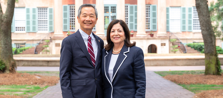
The Zucker family has gifted the College a generous $2.5 million to attract talented engineering students and foster a culture of philanthropy.
By Darcie Goodwin
The College of Charleston has received a generous $2.5 million gift from the Zucker family.
To attract talented engineering students, $2 million will go to scholarships for the newly created School of Engineering, Computing, and Mathematics; and to foster a culture of philanthropy, $500,000 will go to the Zucker Family Challenge on CofC Day over the next five years.
The Zuckers’ scholarship commitment supports the College’s vision for a vibrant School of Engineering, Computing, and Mathematics. The scholarships, with a preference to female and underrepresented minority candidates, will help recruit, inspire and prepare diverse talent from across the country who wish to combine a rigorous engineering education with a broad-based liberal arts curriculum, giving them a unique value proposition in the workforce.
“We are very interested in this area,” says Anita Zucker, who received an honorary degree from the College in 2010. “My late husband, Jerry Zucker, was gifted at math and science. These skills made him the incredible person he was and built our businesses. Couple that with liberal arts, including the importance of communication and writing proficiency, and it completes the person.”
In addition to engineering scholarships, Zucker partnered with the university to create a $500,000 Zucker Family Challenge for the annual CofC Day events. Over the next five years this challenge will both motivate the College’s existing donor base and encourage new donors. During the 2024 CofC Day event, which took place on March 13 and 14, the Zucker Family Challenge awarded $100,000 to match the gifts of 2,000 donors.
Along with financial contributions, Zucker plays an active role at the College. She serves on the President’s Strategic Initiatives Committee, the School of Business Board of Governors and the Yaschik/Arnold Jewish Studies Program Advisory Board.
“We have been so fortunate to have the Zucker family as part of our campus community over the past 30 years,” says College of Charleston President Andrew T. Hsu. “The Zuckers’ latest gift for engineering scholarships will help the College provide a pipeline of talent to our region’s growing high-tech, manufacturing and life sciences industries. We would not be where we are today without loyal donors like the Zuckers.”
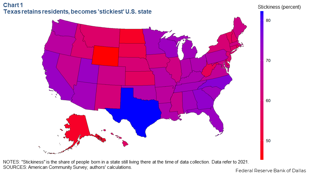
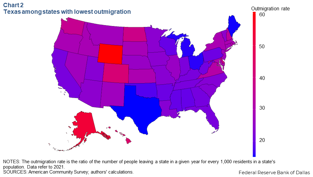
How well does South Carolina keep its native residents? Based on a calculation measuring the share of people born in each state who still live there, Texas is the nation’s “stickiest” state, but South Carolina is 8th best in the nation in retaining its native residents and 8th lowest rate of resident departures. Our natives aren’t leaving. Of the top 10, four are from the Southeast region of the US.
What does stickiness / retained residency mean?
The share of people born in a state and who stay there can provide an important measure of its attractiveness to workers. The stickiness of native residents is also key to maintaining a stable (or growing) population and workforce, which is vital to economic growth.
To figure out which states are best at retaining their native residents, using American Community Survey (ACS) data, it estimated the share of people born in each state who still lived in that state as of the 2021 survey (Below chart).
What makes a state sticky?
Sticky states, where the weather is often warmer, tend to offer better economic conditions than nonsticky states. These conditions can be in the form of better and more varied job opportunities or less burdensome tax policies. Without sufficient employment opportunities, native residents may be pushed to other states to seek good jobs.
The five stickiest states each recorded above-average job growth between 2010 and 2019, meaning there was less pressure for residents to leave to find work. Four of the five stickiest states also have below average state and local tax burdens. Residents born in low-tax states may be hesitant to move to high-tax states, as the additional obligation will reduce take-home pay and may lower their standard of living.
States with multiple cities are at an advantage for stickiness because they can provide native residents with a wider variety of in-state job opportunities and relatively higher wages compared with smaller or less-populous states with fewer urban areas.
Altogether, the five stickiest states have 15 metropolitan statistical areas with populations exceeding 1 million; among the five least-sticky states, there is only one such metro (Providence, Rhode Island). Even when including smaller cities, those top stickiest states have 28 metros with 500,000 or more residents versus still just one among the bottom five.
Let’s look at the numbers:
South Carolina retained 71.87% of its native residents
South Carolina residents that moved: 28.13%
Top 10 of retaining residents: Texas (82.20%), North Carolina (75.52%), Georgia (74.23%), California (73.00%), Utah (72.95%) Florida (72.67%), Wisconsin (72.52%), South Carolina (71.87%), Alabama (71.59%), Michigan (71.53%)
Top 10 lowest moving rate: Texas (17.80%), North Carolina (24.48%), Georgia (25.77%), California (27.00%), Utah (27.05%), Florida (27.33%), Wisconsin (27.48%), South Carolina (28.13%), Alabama (28.41%), Michigan (28.47%)
Free-of-charge robotic companion helps comfort 17 pediatric cancer and sickle cell patients at Prisma Health Children’s Hospital-Upstate in Greenville, South Carolina
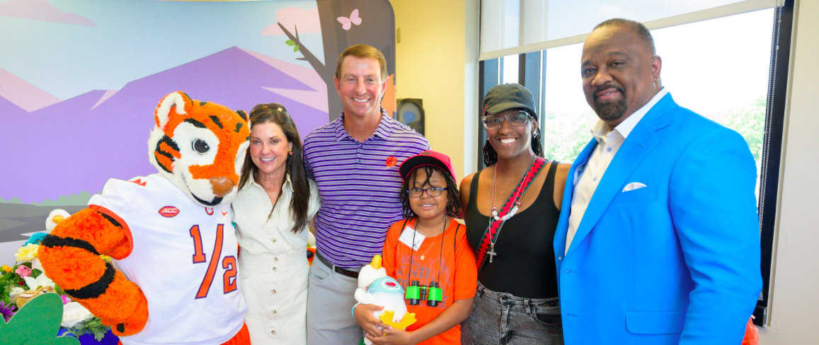
COLUMBUS, Ga., May 28, 2024 /PRNewswire/ — Two-time national champion Clemson University Head Football Coach Dabo Swinney, whose team will kick off the 2024 college football season against the Georgia Bulldogs in this year’s Aflac Kickoff Game, surprised children at Prisma Health Children’s Hospital-Upstate with My Special Aflac Duck, a free-of-charge resource created for children ages 3 and up with cancer and sickle cell disease. In partnership with Aflac, a leading provider of health supplemental insurance in the U.S., Coach Swinney, Aflac U.S. President Virgil Miller and the famous Clemson Tiger delivered My Special Aflac Ducks, helping the children and their families enjoy a great day of fun activities.
Watching the children interact with My Special Aflac Duck shows how we can come together to make a difference
Clemson University Head Football Coach Dabo Swinney joined Aflac U.S. President Virgil Miller to hand out My Special Aflac Ducks to patients at Prisma Health Children’s Hospital – Upstate Tuesday, May 28. Pictured left to right: The Clemson Tiger, Kathleen Swinney, Dabo Swinney, Amir Boyd, Tenesha Boyd and Virgil Miller.
“As Clemson prepares for the upcoming football season, the Tiger and I are excited to team up with Aflac at Prisma Health Children’s Hospital-Upstate as we get ready for the Aflac Kickoff Game in August,” Coach Swinney said. “Our work today impacts both our local community and the pediatric cancer and blood disorder community. Watching the children interact with My Special Aflac Duck shows how we can come together to make a difference on and off the field, and I’m truly honored to be a part of it.”
Since 2018, the award-winning animatronic duck has helped bring more than 30,000 kids comfort and joy during very challenging times. The social robot comes to life using innovative technology, helping kids prepare for medical procedures, communicate their feelings, practice distraction techniques and more. The delivery at Prisma Health Children’s Hospital-Upstate comes on the heels of a three-year study released April 5, revealing that both parents and caregivers reported a reduction in distress, nausea, pain and treatment — and procedural anxiety — for their children who received My Special Aflac Duck, compared to those in the study who had not yet received a duck. My Special Aflac Duck was named one of Time Magazine’s 50 Best Inventions and named Best in Show at CES and South by Southwest in 2018.
Also present at the event was the famed Clemson University mascot, The Tiger, who is set to face off in the Aflac Kickoff Game Mascot Challenge. The mascot will compete at Tailgate Town on Aug. 31, participating in football-inspired activities to bring awareness to childhood cancer and raise funds for the local children’s hospital. The champion will be announced during the Aflac Kickoff Game broadcast on ABC at noon EDT.
Coach Swinney, the winningest head coach in Clemson football history, was joined by Aflac U.S. President Virgil Miller, Prisma Health Executive Vice President and Chief Clinical Officer Dr. Jonathan Gleason, as well as patients, parents and health care providers at the hospital. The day included a demonstration of My Special Aflac Duck as well as fun activities for the young patients, including a scavenger hunt that culminated in each child receiving their very own My Special Aflac Duck.
“The My Special Aflac Duck program has become a hallmark of our commitment to helping families with pediatric cancer and blood disorders such as sickle cell. We are thankful to Coach Swinney and the wonderful staff at Prisma Health Children’s Hospital-Upstate for teaming up with Aflac today to help these children and their care providers,” said Aflac U.S. President Virgil Miller. “To date, Aflac has given more than 30,000 ducks and donated more than $180 millionto childhood cancer and blood disorders. A recent three-year clinical trial confirmed what we knew intuitively that this robotic companion helps young patients cope with treatment-related distress and anxiety. We will continue to bring awareness to this important cause through the Aflac Kickoff Game in partnership with Peach Bowl Inc.”
“We sincerely appreciate Coach Swinney joining the My Special Aflac Duck delivery today and visiting with these young patients and their families to provide a resource that will have a positive impact on these children during their medical journey,” said Gary Stokan, Peach Bowl Inc. CEO and president.
“We’re grateful to Aflac for its commitment to helping children with cancer and blood disorders such as sickle cell disease — and especially for its commitment to helping children here in the Upstate,” said Dr. Robin LaCroix, medical director of the Prisma Health Children’s Hospital-Upstate. “This incredible, utterly huggable technology creates an interactive experience that gives children coping tools to help reduce stress and pain and even brings fun and laughter into what can be a difficult time for children and their families. It is wonderful that Coach Swinney, a long-term champion of Prisma Health Children’s Hospital-Upstate, has joined forces with Aflac to yet again bring smiles to the faces of the families we serve.”
Health care providers, support organizations and families can order My Special Aflac Duck free of charge for children 3 years or older who have been diagnosed with cancer or sickle cell disease at myspecialaflacduck.com.
ABOUT AFLAC INCORPORATED Aflac Incorporated (NYSE: AFL), a Fortune 500 company, has helped provide financial protection and peace of mind for more than 68 years to millions of policyholders and customers through its subsidiaries in the U.S. and Japan. In the U.S., Aflac is the No. 1 provider of supplemental health insurance products.1 In Japan, Aflac Life Insurance Japan is the leading provider of cancer and medical insurance in terms of policies in force. The company takes pride in being there for its policyholders when they need us most, as well as being included in the World’s Most Ethical Companies by Ethisphere for 18 consecutive years (2024), Fortune’s World’s Most Admired Companies for 23 years (2024) and Bloomberg’s Gender-Equality Index for the fourth consecutive year (2023). In addition, the company became a signatory of the Principles for Responsible Investment (PRI) in 2021 and has been included in the Dow Jones Sustainability North America Index (2023) for 10 years. To find out how to get help with expenses health insurance doesn’t cover, get to know us at aflac.com or aflac.com/espanol. Investors may learn more about Aflac Incorporated and its commitment to corporate social responsibility and sustainability at investors.aflac.com under “Sustainability.”
1 LIMRA 2022 US Supplemental Health Insurance Total Market Report
ABOUT PRISMA HEALTH Prisma Health is a private nonprofit health company and the largest health care organization in South Carolina. The company has 29,309 team members, 18 acute and specialty hospitals, 2,827 licensed beds, 305 practice sites, and more than 5,400 employed and independent clinicians across its clinically integrated inVio Health Network. Along with this innovative network, Prisma Health serves almost 1.5 million unique patients annually in its 21-county market area that covers 50% of South Carolina. Connect with Prisma Health on Facebook, Instagram, LinkedIn and Twitter/X.
Every day, we see tourists come to the area by car, plane and boat. They shop, dine, lounge, explore, adventure and provide a vital contribution to our economy. Whether it is the fine dining, nationally recognized festivals, outdoor adventures, romantic getaways, friendship vacation or an exploration into our rich history, Charleston has become a national and international destination.
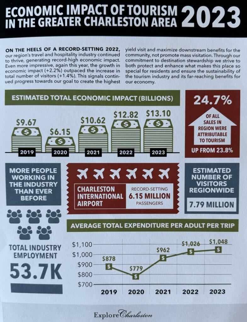
We wanted to provide a consumable look, by the number at the incredible economic impact tourism has on the Greater Charleston, South Carolina economy. Get ready to be blown away!
Estimated total economic impact (billions) – 2023 – $13.10B vs 2019 – $9.67B (35.5% increase).
More people working in the hospitality and tourism industry in the Greater Charleston area than ever before: 53.7K employed.
Average total expenditure per adult per trip: 2023 – $1,048 vs 2019 – $878 (19.4% increase). Breakdown: $503 (accommodations), $234 (dining/food), $63 (local transportation), $100 (tours/attractions), $103 (retail shopping), $45 (other shopping/expenses).
Charleston International Airport had a record-setting year with 6.15M passengers coming in and out of the airport.
Percentage of all sales in the region that were attributable to tourism: 24.7% (up from 23.8% the previous year).
Hotel Average Occupancy Rate: 70.7% with a record 4.9M hotel rooms sold in 2023. The national average is 63.8%.
Average Hotel Rate: $185/night up from $155/night in 2019.
Top origin states (Non-SC) for visitors: North Carolina, Florida, Georgia, Virginia, New York, Pennsylvania, Ohio, Tennessee, Texas, New Jersey.
Top origin cities (Non-SC) – Charlotte, New York, Atlanta, Washington, DC, Miami, Philadelphia, Jacksonville, Raleigh, Orlando, Tampa.
Number of airlines now flying in/out of Charleston International Airport: 13.
These are some remarkable numbers and our economic future is only looking brighter.
How much do you know about Charleston, South Carolina. We are about to find out.
Here are 5 somewhat rare facts about downtown Charleston, SC:
1. The Dock Street Theatre, built in 1736, is considered the first building constructed specifically for theatrical performances in America.
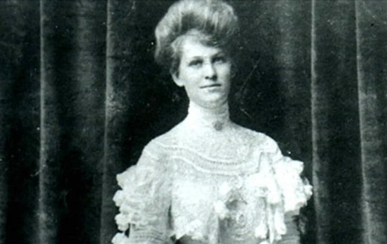
2. Charleston was home to America’s first female newspaper editor and publisher, Elizabeth Ann Timothy, who took over the South Carolina Gazette in 1738.
3. The layout of downtown Charleston is nearly identical to Bridgetown, the capital of Barbados, with features like cobblestone streets, colonial buildings, and crepe myrtle trees mirrored in both cities.
4. One of the theories surrounding the infamous Lavinia Fisher, dubbed America’s first female serial killer, suggests her arrest and execution may have been a setup, and she may have been innocent.
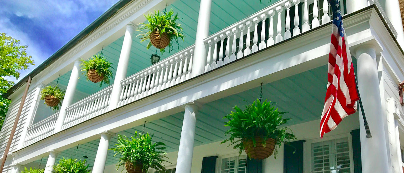
5. Many historic Charleston homes have ceilings on their piazzas (covered porches) painted “haint blue,” a soft blue-green color used by Gullah Geechee people to ward off evil spirits.
CHARLOTTE, N.C., May 29, 2024 /PRNewswire/ — On Thursday, May 23, Carolinas AGC partnered with AGC of Americaand North Carolina Department of Transportation (NCDOT) for a press conference to release the results of AGC of America’s 2024 Work Zone Safety Awareness Survey consisting of results from CAGC Members. The survey results highlighted the dangers of highway work zones for motorists and workers in North Carolina, South Carolina and nationwide.
At the unveiling, held at the North Carolina Department of Transportation facility in Raleigh, N.C., AGC of America’s national spokesman Brian Turmail released the results of the survey; North Carolina State Representative Dean Arp released new details of a legislative measure to improve highway work zone safety; Chris Peoples, the COO of the North Carolina Department of Transportation, discussed steps the state is taking to make highway work zones safer and shared tips for motorists; and Skip Partington, vice president with Barnhill Contracting, painfully discussed a recent tragedy that involved a Barnhill employee who was killed recently in a highway work zone crash.
Some troubling facts that came out of the survey include:
84% of contractors in North Carolina, 77% in South Carolina, and 64% nationwide, reported at least one crash in the past year involving a moving vehicle at highway work zones where they operate.
56% of North Carolina contractors and 62% in South Carolina reported experiencing five or more crashes during the past twelve months, compared to only 33% nationally.
24% of North Carolina contractors reported that a construction worker was killed in a crash in their work zones (none in South Carolina) while 29% of NC respondents and 27% of SC respondents who experienced crashes reported drivers or passengers were killed.
In addition to the legislative measures in North Carolina presented by Arp at the survey’s unveiling, in South Carolinanew legislation—pushed by Carolinas AGC—will modernize the state’s driver training for all newly licensed drivers. This legislation, signed into law by Gov. Henry McMaster, makes South Carolina only the third state in the country to require construction work zone training be included in the training all new drivers receive before they can obtain a driver’s license.
“We are excited to have worked with Rep. Gary Brewer and Sen. Ross Turner, our lead sponsors, to enact this legislation,” Leslie Clark, Carolinas AGC COO and SC Divisions Director, said. “There’s nothing more important than our members returning home safely to their families after working tirelessly to maintain, improve, and build our state’s roads and bridges. We hope that all newly licensed drivers, after receiving this training, will understand the importance of safely navigating a construction work zone when they are operating a vehicle.”
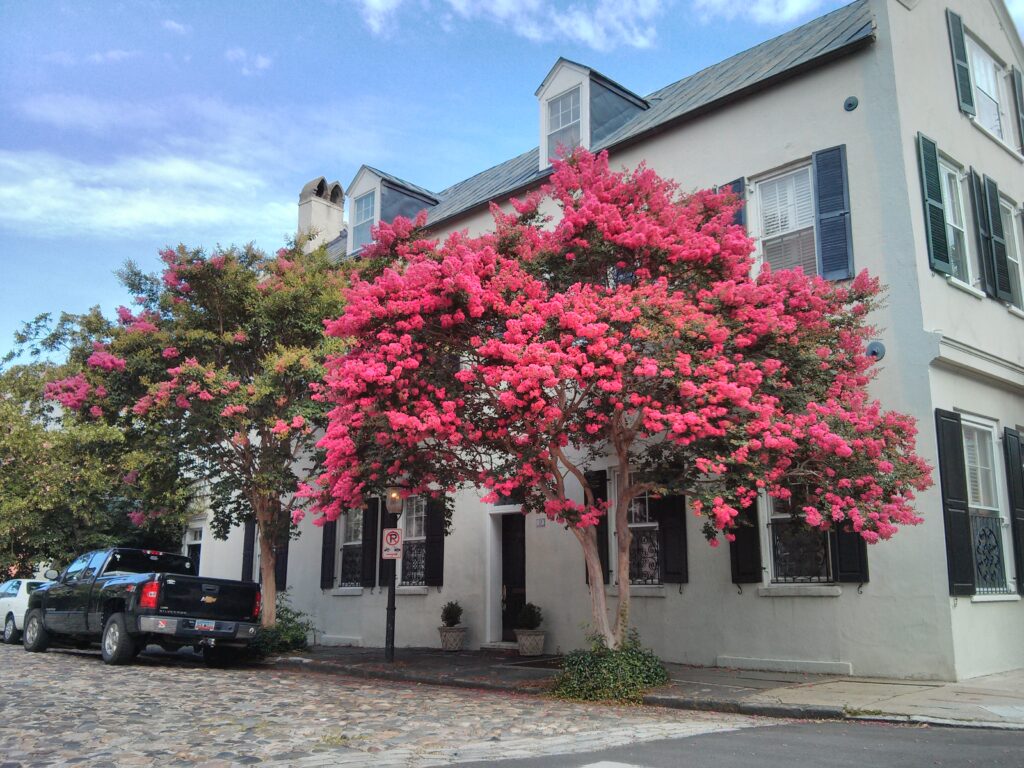
Crepe Myrtle: With its arching branches and bright pink, red, and white flowers, this tree is a Southern staple.
Southern Magnolia: Charleston is famous for its magnolias, which are native to South Carolina. These trees produce gorgeous white, saucer-like flowers with a wonderful scent.
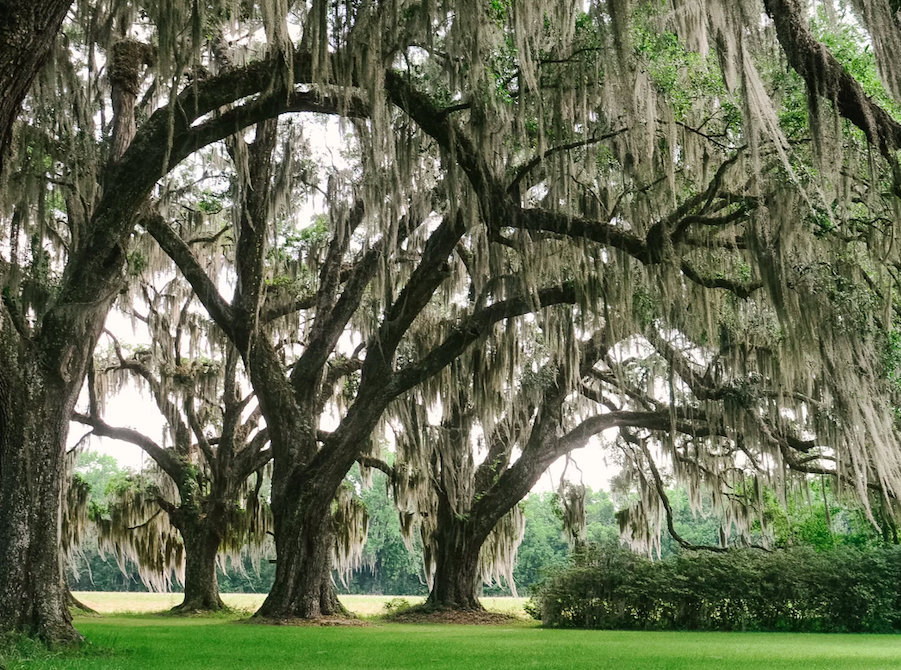
Southern Live Oak: Quercus virginiana, also known as the southern live oak, is an evergreen oak tree endemic to the Southeastern United States. Though many other species are loosely called live oak, the southern live oak is particularly iconic of the Old South. Many very large and old specimens of live oak can be found today in the Deep South region of the United States.
Crepe Myrtle
Southern Magnolia
Southern Live Oak
Flowers
Azaleas: These shrubs burst forth with blooms of hot pink, red, and white in the spring. You’ll spot them in yards, gardens, and parks all over Charleston.
Camellias: These evergreen shrubs and trees thrive in Charleston’s climate, blooming in a variety of colors like white, pale pink, and red from December to early spring.
Wisteria: A high-climbing, trailing vine that drips clumps of lilac blooms in a showy display of springtime beauty.
Noisette Roses: Charleston is the birthplace of this famous garden rose, the only class of rose to originate in the US. They bloom from late April until the first frost.
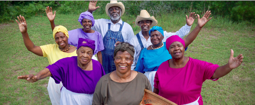
Here are 5 things you may not have known about the Gullah Geechee community in the Lowcountry region of South Carolina and Georgia:
1. The Gullah language is a creole language combining English with various West African languages. It has unique grammar, intonation, and vocabulary influenced by the enslaved Africans’ mother tongues.
2. Gullah cuisine evolved from enslaved African women blending ingredients and techniques from their homelands with local foods like rice, seafood, and vegetables. Iconic dishes like gumbo, shrimp and grits, and red rice originated from their ingenuity.
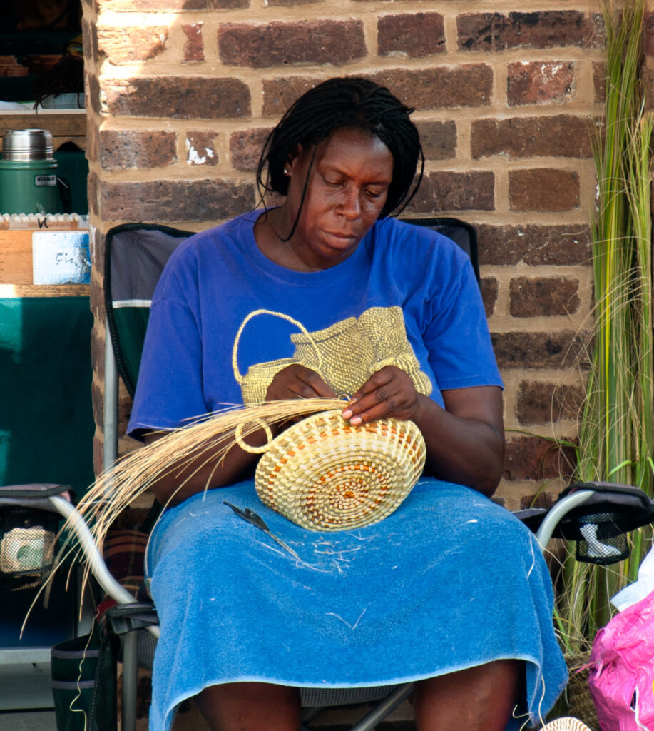
3. Sweetgrass basket weaving is an important Gullah craft with roots in African basket-making traditions. The intricate sewn patterns and utilitarian baskets were passed down through generations. Please follow Charleston’s Corey Alston, whose exquisite basket weaving skills date back generations.
4. The bright “haint blue” color seen on porch ceilings is a Gullah tradition believed to ward off evil spirits. This practice originated in West African spiritual beliefs.
5. Isolated on the Sea Islands for generations allowed the Gullah Geechee people to retain more African cultural influences compared to other African American communities. Their language, foodways, crafts, and folk traditions have strong African retentions.
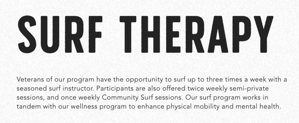
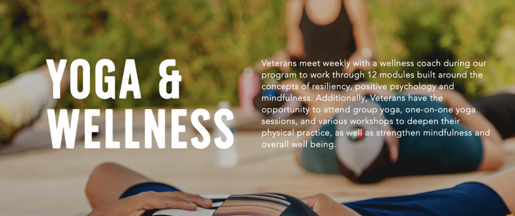
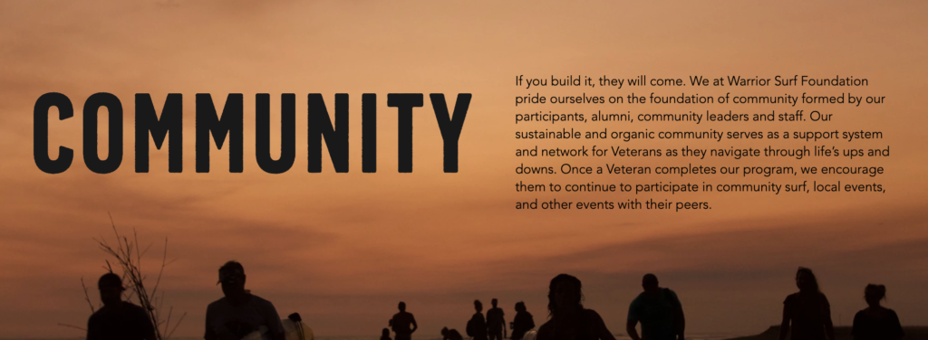
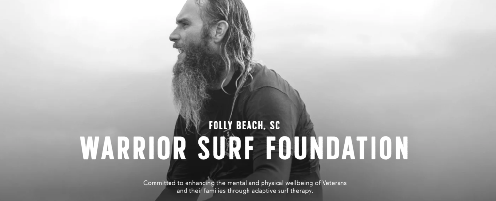
“There is something about the ocean. You feel cleansed.” – Andrew Manzi, Founder, Warrior Surf
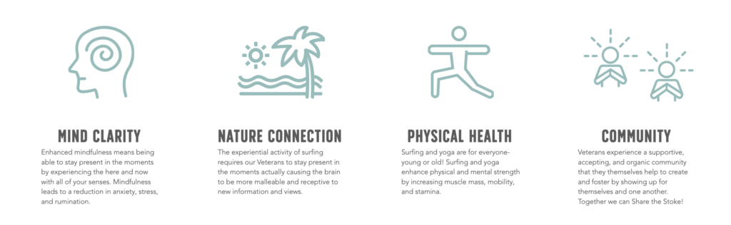
Challenges Veterans Face
Veterans transitioning back to civilian life often face emotional, physical and psychological challenges assimilating back into a life they once knew, but has forever changed due to the experiences and challenges they faced in uniform.
Mission and Value of Warrior Surf
Finding an outlet, a clan, a place where they are understood with patience, compassion and acceptance is a gift upon itself.
That is the true mission of Folly Beach’s Non-Profit Warrior Surf.
The vision statement says it all: “We establish hope in the lives of veterans and their families – One wave at a time.”
Warrior Surf has grown from a passion project made up on a canopy at Folly Beach and a few inspired individuals, led by Andrew Manzi, with a vision to a community of veterans, educators, ambassadors and healers.
We are honored to have this organization as part of the Lowcountry community. Their dedication and commitment to the tireless kindness they have given to all those that have and continue to go through their programs and remain as part of the Warrior Surf family is an inspiration.
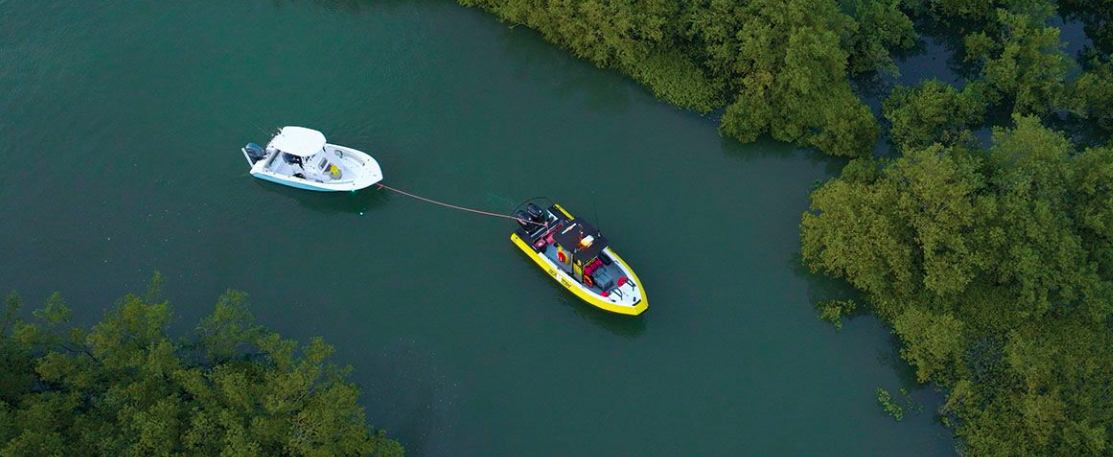
Southold, NY – May 26, 2024 – As boating season goes to full throttle, Sea Tow®, recognized throughout the marine industry as Your Road Service at Sea®, predicts a busy season out on the water. According to the National Marine Manufacturers Association’s (NMMA) 2023 Economic Impact Study on Recreational Boating, there are an estimated 85 million Americans who go boating each year.
Summer is the perfect time to embark on a boating adventure and enjoy the beauty of the water. Whether it’s a seasoned boater or someone new to the experience, proper preparation ensures a safe and enjoyable day on the boat. Sea Tow is sharing a step-by-step guide for boaters to prepare for a day out on the water.
Check the Weather Forecast – Before heading out, always check the weather forecast for the day. Summer weather can be unpredictable, so boaters should ensure they’re prepared for any changes in conditions. Avoid going out during storms or high winds, and plan accordingly based on the forecast.
Prepare The Boat – Inspect the boat thoroughly before departure. Check the engine, fuel levels and overall condition of the vessel. Ensure all safety equipment such as life jackets, fire extinguishers and navigation lights are in good working order and readily accessible.
Pack Essential Supplies – Gather essential supplies for a comfortable day on the water. This includes sunscreen, sunglasses, hats, towels, snacks and plenty of drinking water to stay hydrated under the sun. Bring appropriate clothing layers in case of temperature changes or unexpected weather.
Plan The Itinerary – Decide on the route and destinations for the day. Whether boaters are fishing, cruising, or engaging in water sports, having a plan ensures they make the most of their time on the water. Boaters should familiarize themself with the area’s navigational markers and potential hazards.
Review Safety Procedures – Ensure everyone on board understands basic safety procedures and knows the location of safety equipment. Teach passengers how to wear and use life jackets properly. Assign designated roles such as a lookout or spotter if engaging in water activities. Designate a Sober Skipper for the day.
Follow Local Regulations – Captains shouldfamiliarize themself with local boating regulations, including speed limits, no-wake zones and anchoring restrictions. Adhering to these rules ensures everyone’s safety on board. Check out U.S. Coast Guard Boating to stay up to date on the boating regulations in the area.
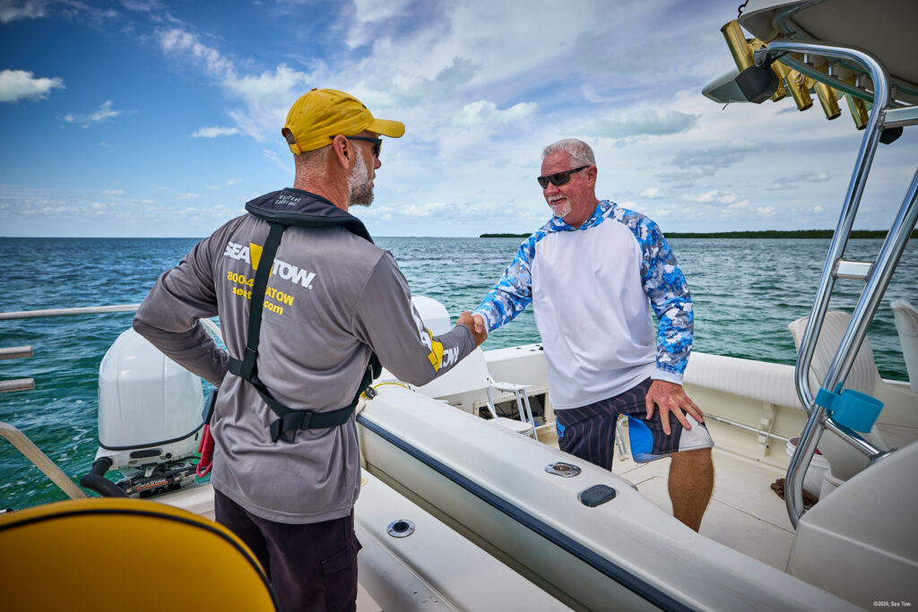
Consider On-Water Assistance Services – Have a backup plan and consider becoming a member of an on-water assistance provider, such as Sea Tow. These services provide assistance in case of dead batteries, mechanical breakdowns, fuel issues or other unexpected mishaps on the water.
By following these steps and taking necessary precautions, boaters will be well-prepared to enjoy a memorable day on the water. Whether boaters are cruising along the coastline or exploring their local lake, proper preparation ensures a fun-filled boating experience.
“We want boaters to enjoy their time on the water and that starts with being prepared and knowledgeable of best practices,” said Sea Tow President Kristen Frohnhoefer. “Sea Tow Captains are a boater’s resource on and off their boat, and on and off the water. We’re confident that these tips from Sea Tow captains will ensure a fun day on the water for all this summer.”
At the forefront of on-water assistance since 1983, Sea Tow marked its 40th anniversary in business in 2023. In 500+ ports nationwide including the continental U.S., Alaska and Puerto Rico, Sea Tow is a member-driven, franchise-based business and technological innovation has been a large driver of its evolution and expansion. Having broken barriers in the industry, it is the premier provider of non-emergency on-water assistance, and also handles salvage and recovery services, response to catastrophic events and marine spill response. Sea Tow is Your Road Service at Sea®.
With a Sea Tow membership, boaters pay one annual rate of $249/year for Gold Card membership and $169/year for Lake Card membership and receive the most comprehensive on-water assistance services available. Sea Tow offers its members free boat towing in their home area, tow coverage to repair facilities on all covered vessels, alternatives to towing such as battery jumps, fuel delivery, covered ungroundings disentanglements and more, along with additional paid on-water services such as boat salvage and recovery, vessel for hire and environmental response.
About Sea Tow Services International, Inc.
Sea Tow Services International Inc., better known as Sea Tow®, has been the innovative and premier leader of on-water assistance for 40+ years. Servicing the United States, Puerto Rico and the U.S. Virgin Islands, members are provided with a 24/7 connection to Coast Guard-Licensed Captains. The pioneering concept, founded by Captain Joseph Frohnhoefer, was established in Southold, NY when the United States Coast Guard ceased response to non-emergency assistance calls. In addition to on-water assistance, the franchise network handles salvage and recovery operations, and responds to natural disasters, environmental hazards and oil spill cleanups. Visitseatow.com to learn more or follow along on Facebook and Instagram.